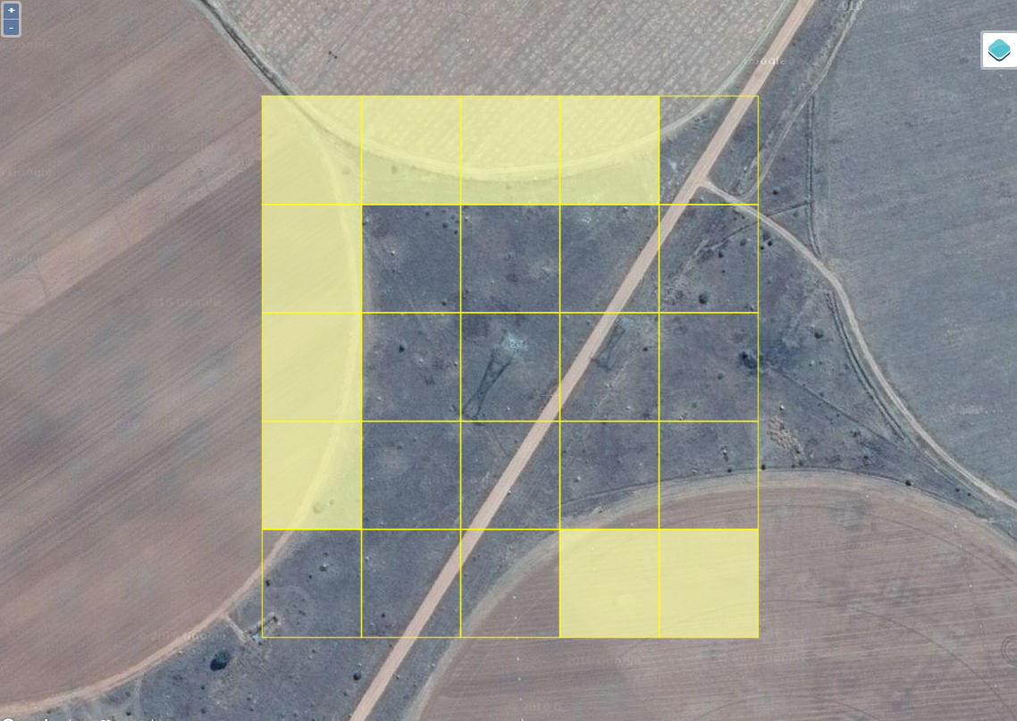
Example 1: Below you will see an example of center pivot irrigation agriculture.
Here we would shade only those squares that contain more than 50% of cropland.
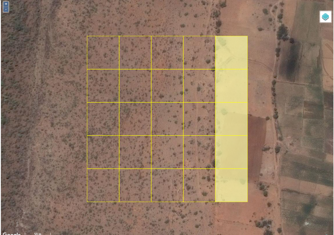
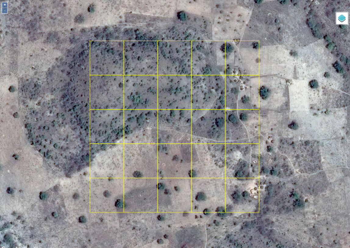
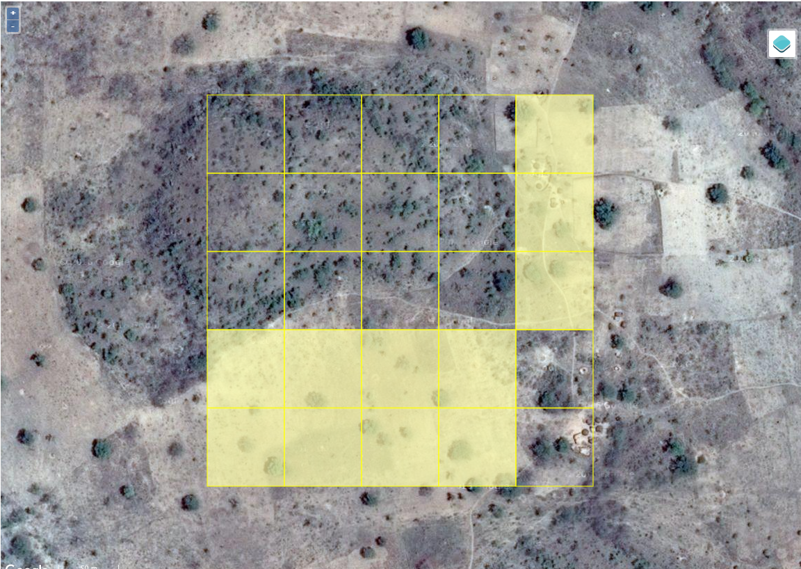
Example 2: Here we see mostly scattered shrubs but some evidence of cropland on the right.
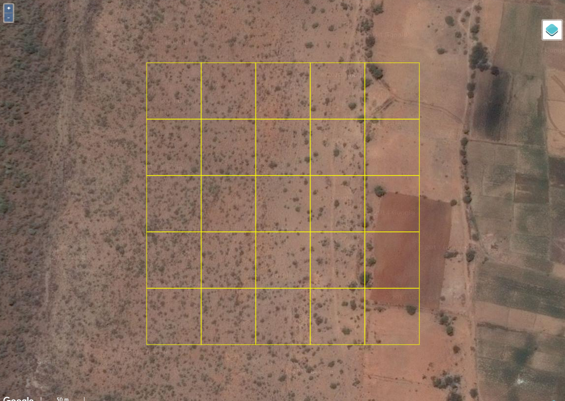
Thus you would shade in the squares on the right.
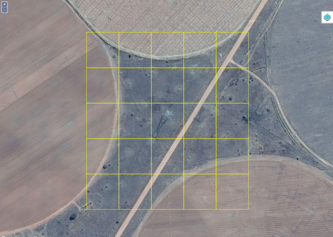
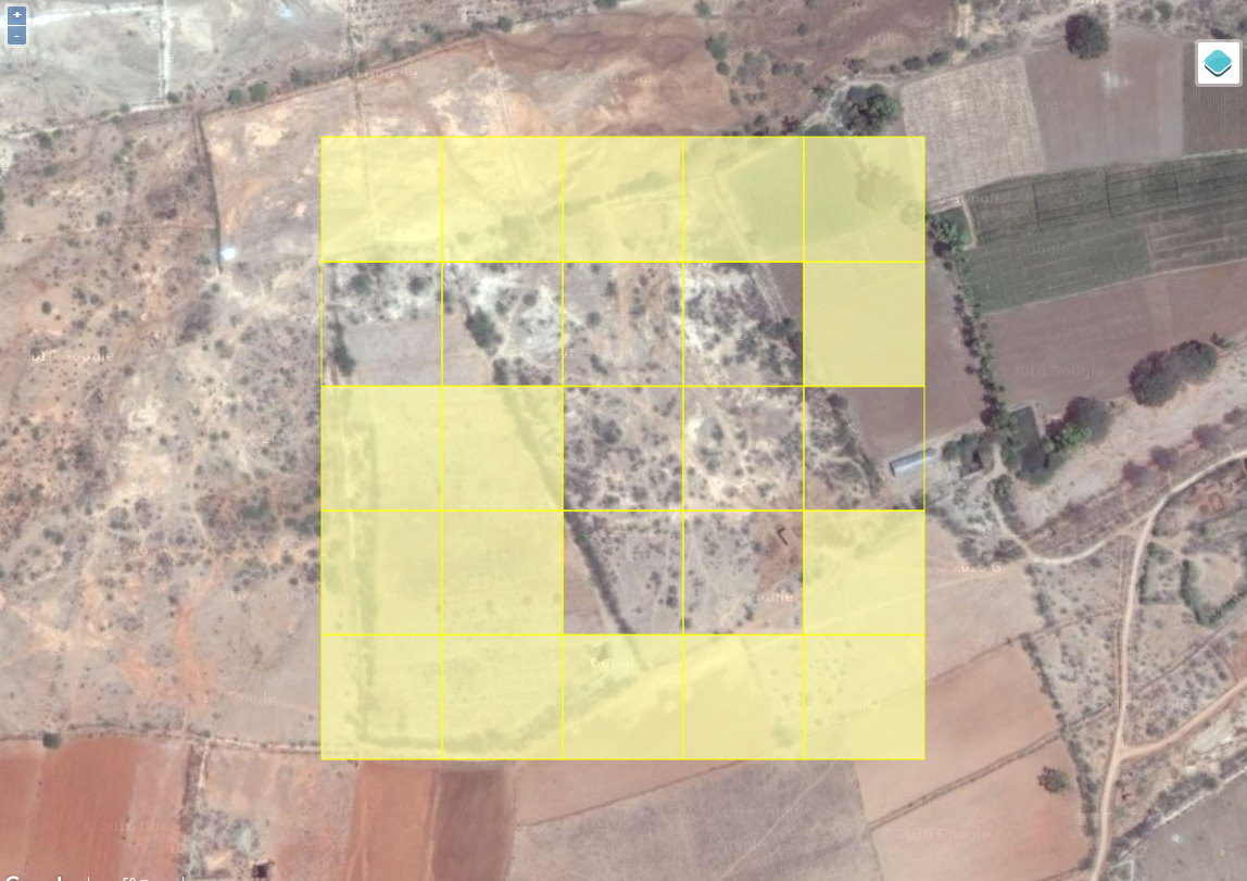
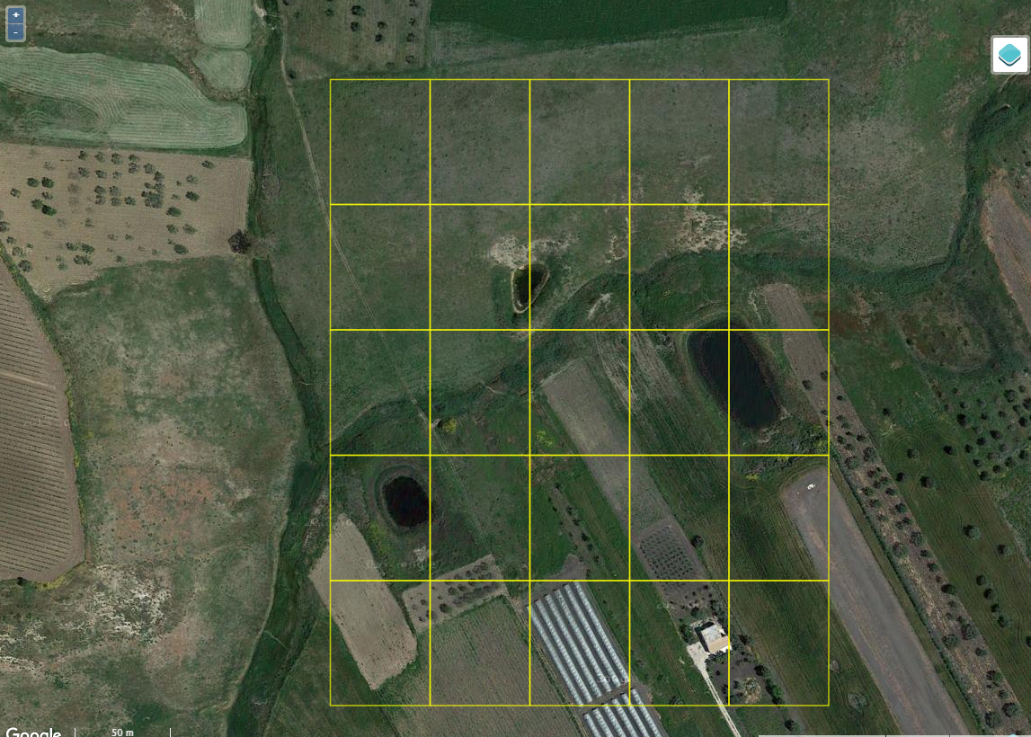
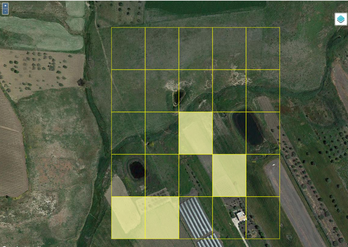
Example 3: Here we see some fields and other areas that have no agriculture in the middle.

Hence we shade most of the pixels on the edges that contain more than 50% cropland.
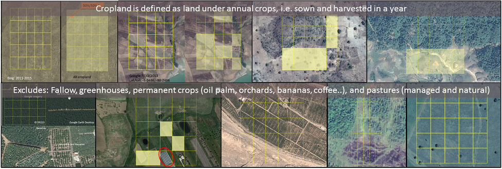
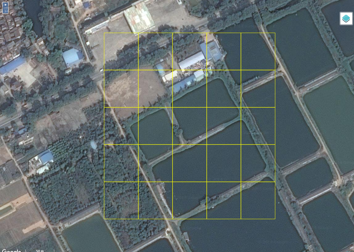
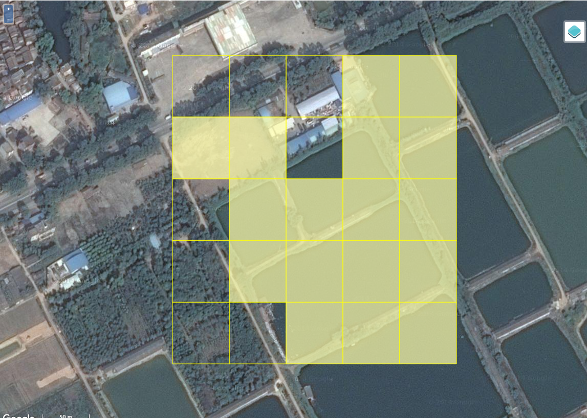
Example 4: Here we see cropland but also greenhouses at the very bottom. Greenhouses are not included in our definition of cropland.
Hence we would not shade the greenhouses but only those squares with more than 50% cropland as shown below.
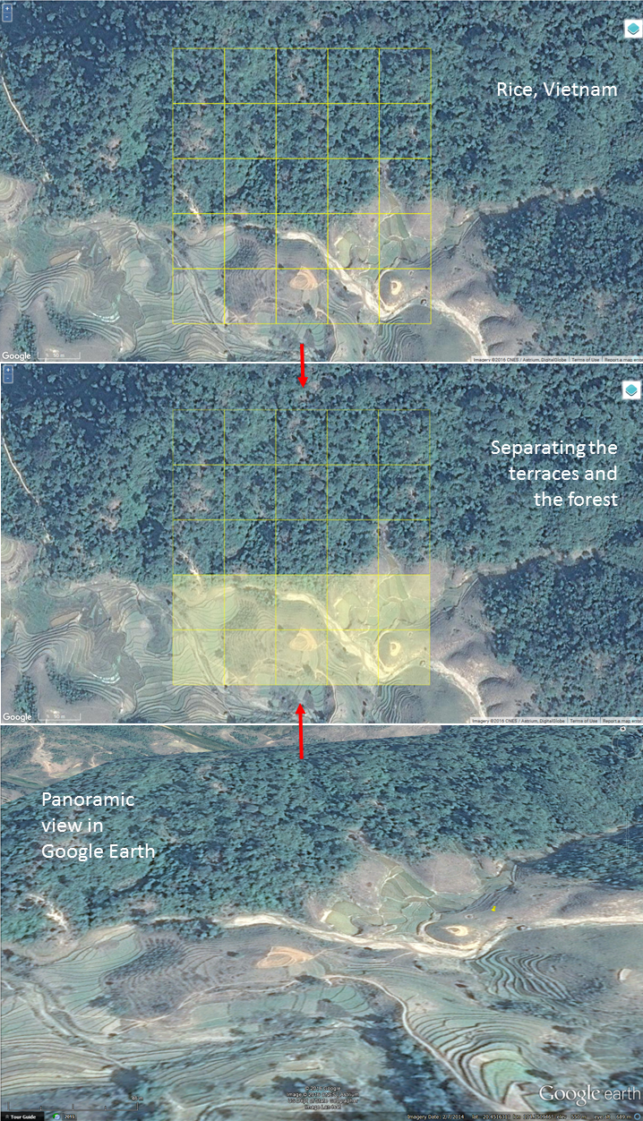
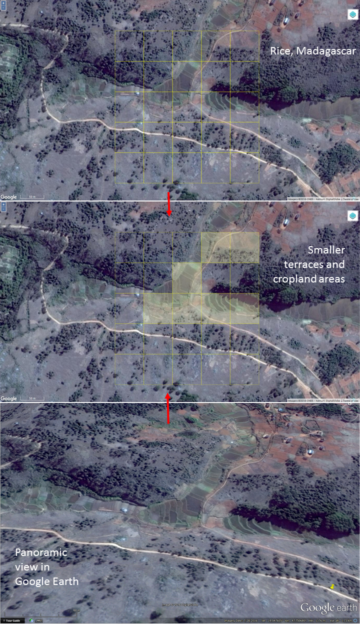
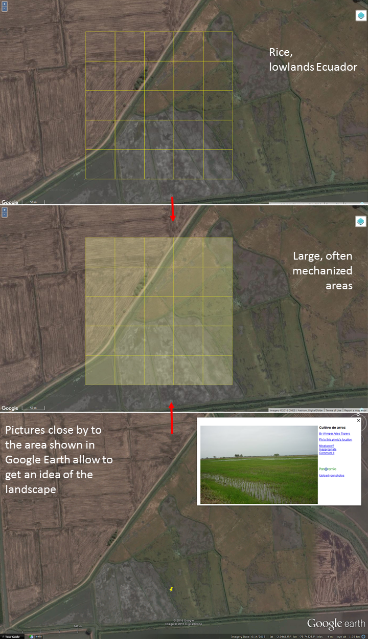
Example 5: This is example of what wetland rice looks like.
Hence we would shade the squares with more than 50% wetland rice cultivation.
Example 6: Here we see a typical landscape in Africa with evidence of agriculture.
Thus, we would shade those squares showing fields.
Rice Examples: The following pictures are showing rice in different areas of the world.
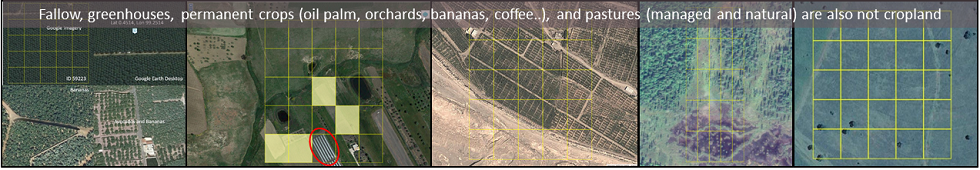
All of these examples show other land cover types beside cropland. Thus you would leave these blank and just push the Submit button to move to the next validation point.
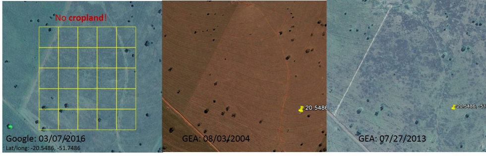
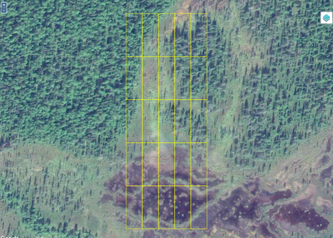
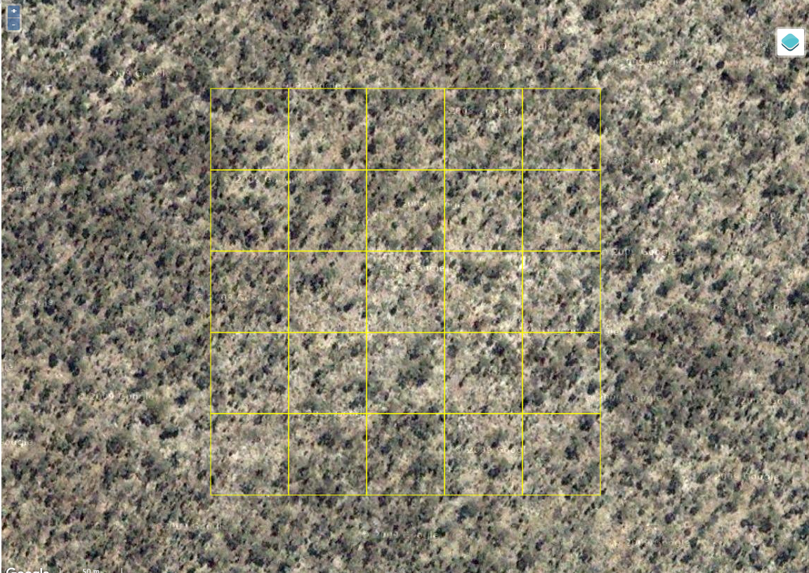
Example 1: This is an example of a boreal forest in the high latitudes. There is no evidence of cropland here.
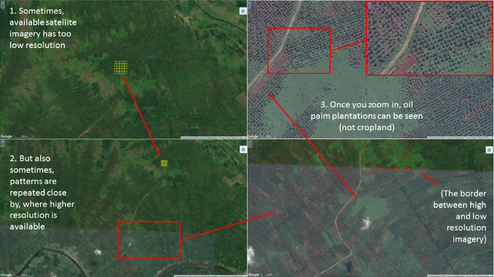
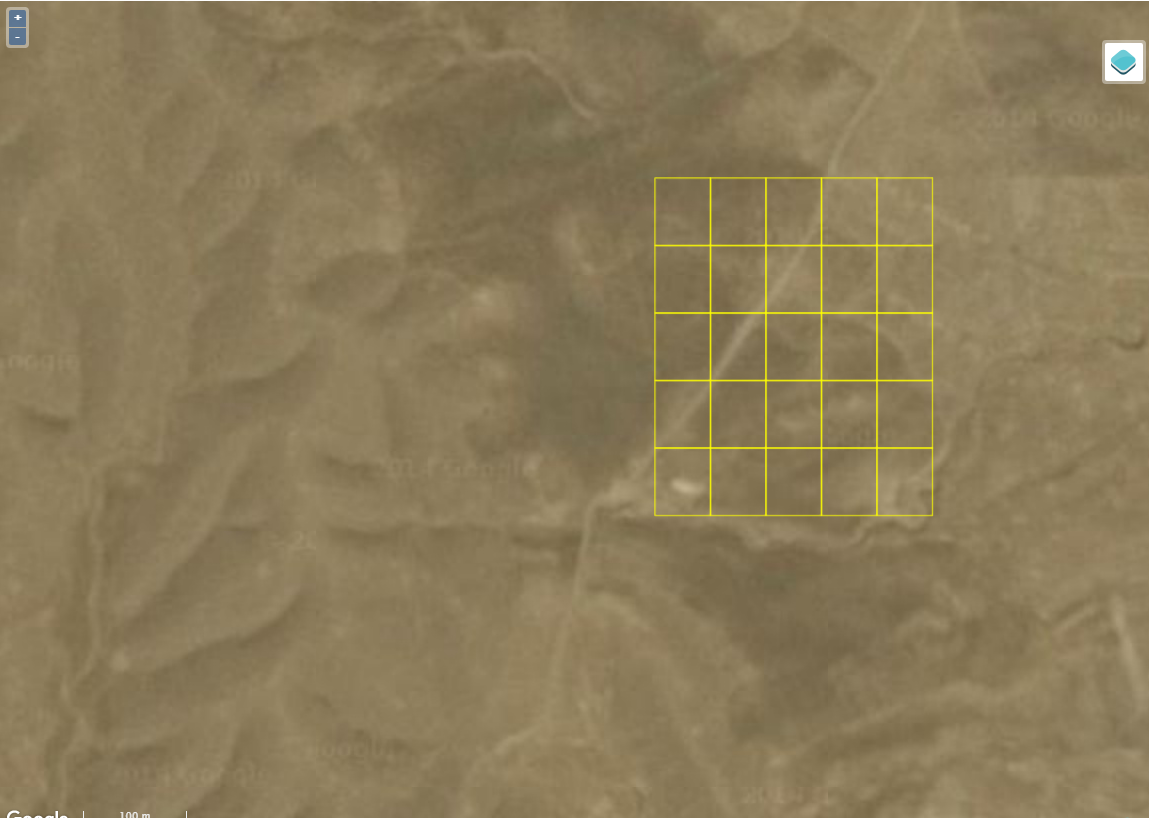
Example 2: This is a low resolution image so it’s useful to zoom out and get a better perspective. However, there is no evidence of cropland here.
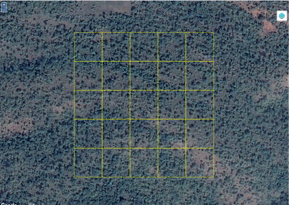
Example 3: Here we see tree cover, some scattered trees and no evidence of cropland.
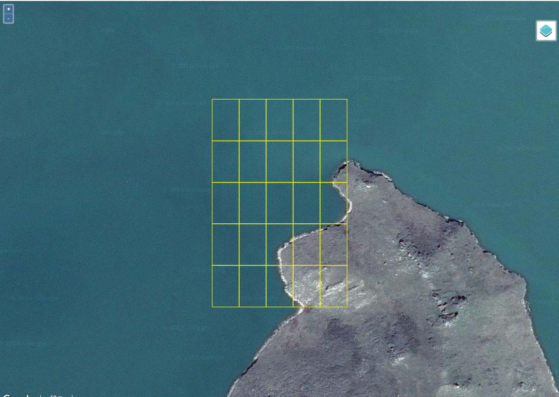
Example 4: This is the edge of an island showing mostly water and either a herbaceous or rocky surface.
Example 5: No evidence of cropland in this image.
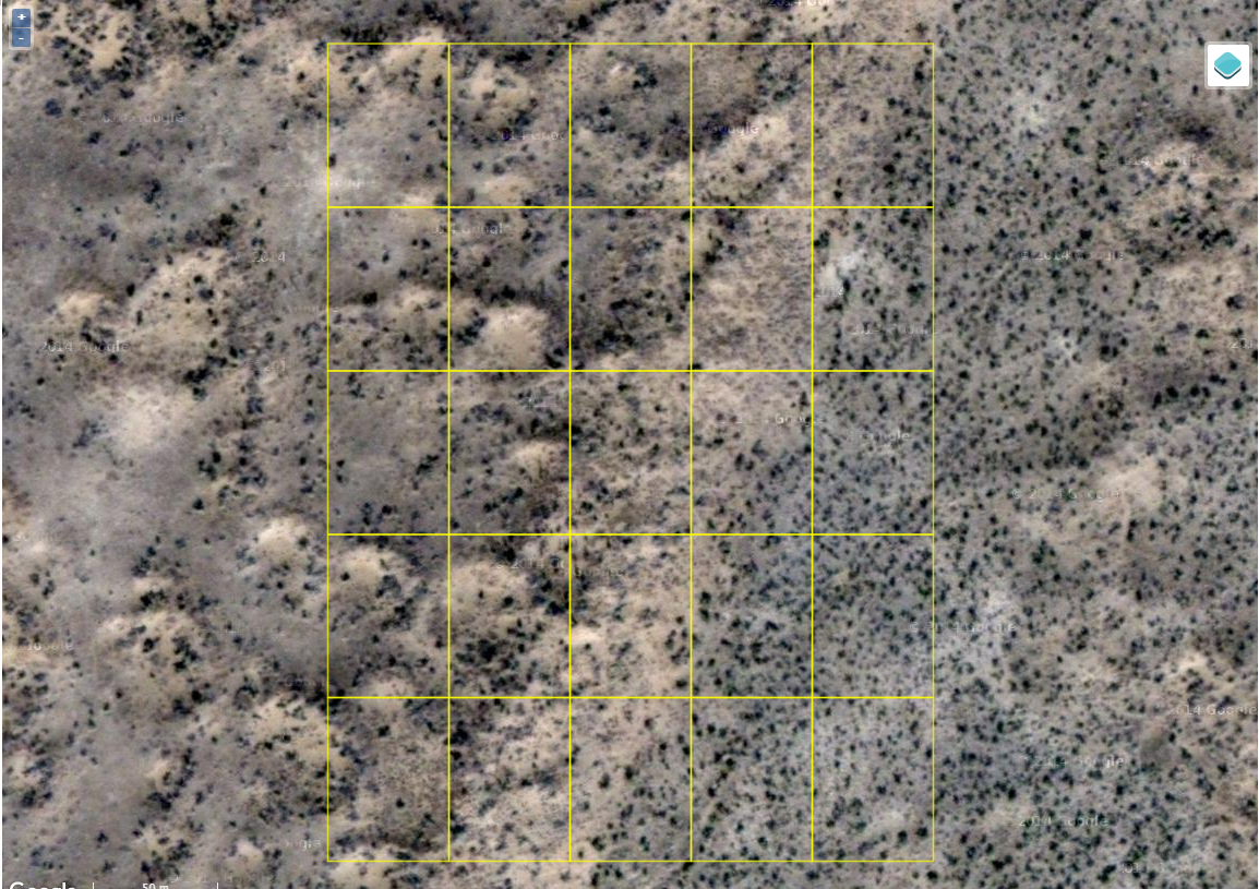
Example 6: No evidence of cropland in this image.
Example 7: